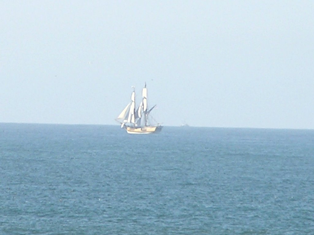

My cute crew from Lady Washington had said they were disembarking at "dark thirty" for Monterey, but as I was breaking camp, there she was. I spent the next hour watching her make way, and set her sails (pic). Since there are 10 sails, and a hodge-podge volunteer crew, that is quite a chore! Certainly has sparked my interest in spending a couple of weeks on her as a crew in San Diego :'). Having sailed before, and being of a quirky, anal, thought process (those of you that have heard my question of flight time/speed west to east know...), I wondered what the proper terminology was for setting sails on a tall masted ship. In all of my sailing on sloops, you raised, or hoisted, the sail (literally) to set them, and lowered the sail to take them down. Only, with tall ships the sails drop down from their booms to set. Probably "setting" is proper.
Sheesh, gotta get a life...
I decided to let caches set the agenda for the day. First one was just a micro marking an obscure entry point to the trail that runs along the bay through the state park. Next up was Bret and Bart's... (gcjehc) which took me to the parking lot/ trailhead to the Mavericks. You easterners may not have heard of them, but the Maverick's is a reef off of Pillar Point that produces some of the biggest and best surfing on the west coast. Once a year they have a major competition, invitation only, for the world's best surfers. They are given one days or so notice, based on forcasts and storm generated surf, and they fly in from all over the world to compete. Google Maverick's and you will see some spectacular surf shots. They also have a webcam on them from the bluff.
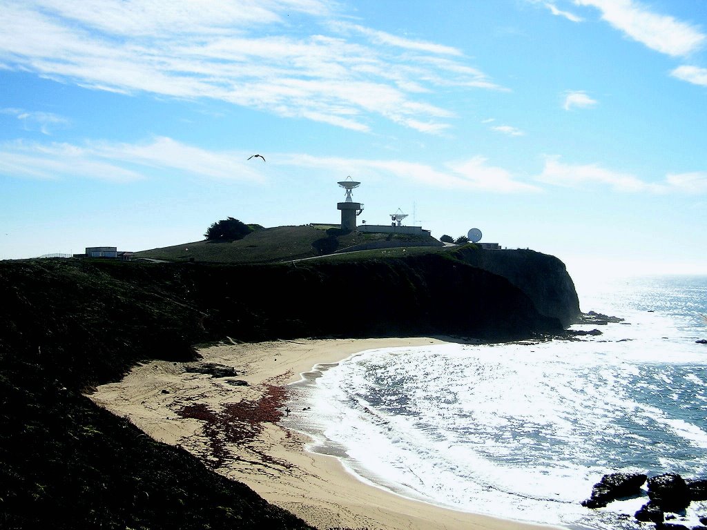
Anyways, back to the cache. Pillar Point is home to a Air Force Military installation. The mavericks are on one side, the harbor on another, the airport just N.E. of it and then some hills just North. I always wondered about those hills, and how to access them. Now I know. They are called P.P. Bluffs, and a trail loops them. On the ocean side, under a cypress, lay the cache. Good enough. But, from the spot, you can see the mavericks and also look at the AF installation from a level point (pic). Radar dishes and whatnot (pic). As you follow the trail north along the ocean ridge, you are now looking at the southern most part of Fitzgeralds reef. Come to find out, P.P. harbor is within the marine reserve. Loop around and now overlook the airport. This was quite fun, watching the planes take off and land from above. Next, i noticed the police cars. Two groups of 6 or 8. They were sharing the airport with the planes, doing high speed driving/pursuit training. That was definitely interesting. All kinds of configurations, with instructors being lead (bad guy) and the rest giving chase. They evidently have to maintain certain distances, and had to make exactly the same manuever as the lead. Watching them do 90 % 's at 60 or so, and then having the tire squeal reach me a few seconds later, due to the distance, was almost comical.
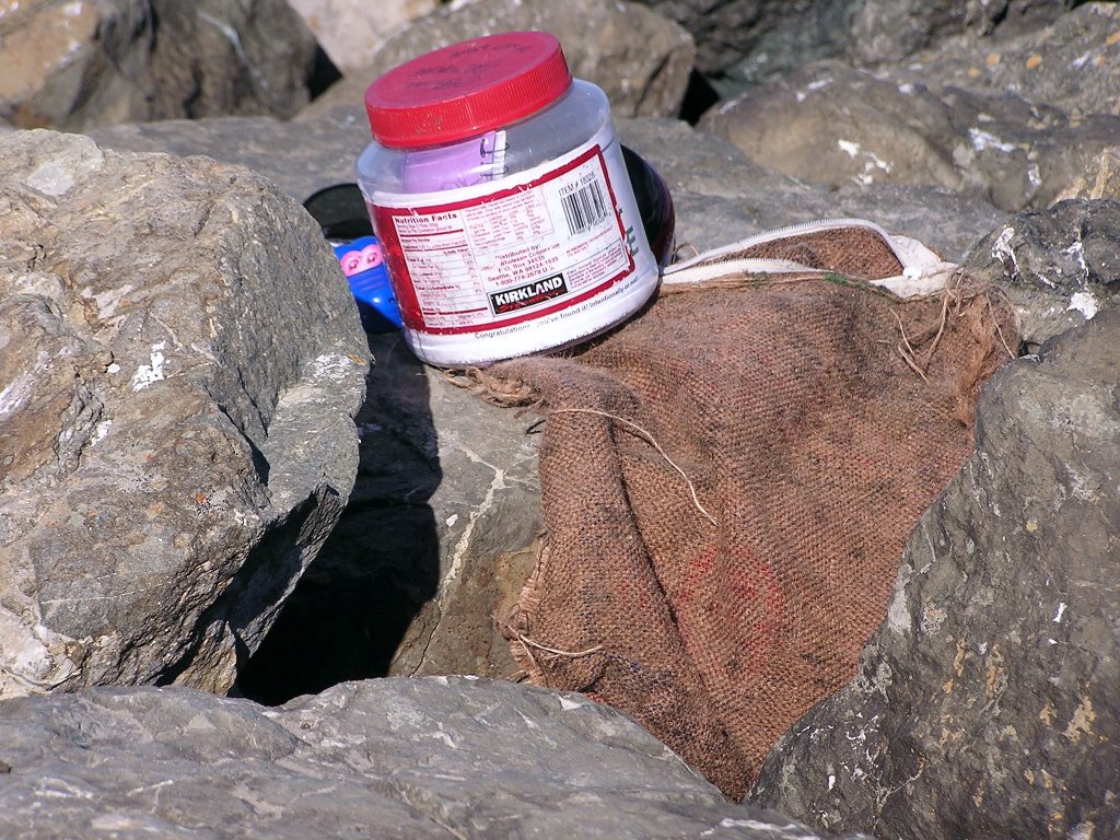
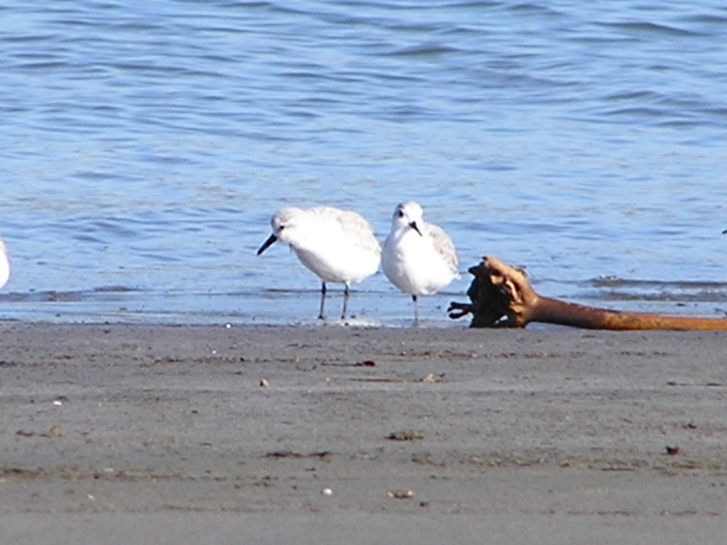
All of this made for a great hike. Back at the parking lot and after lunch, I realized there was another cache in the vicinity, but it showed as being off-shore? Going to the description, I realized it was on the jetty to the harbor, and I would not have to kayak or surf to it. Better luck was that it was low tide, so I did not even have to rock-hop a quarter mile of the jetty. A very ingenious disguise to the cache. it was stashed in a weathered burlap bag, wedged in the rocks, appearing to be part of the flotsam that littered the jetty. I rescued a teddybear TB for its owner and headed back via the beach. Oh, the cache is Piedras Mojadas (gcmwch)(pics). Walking the beach in low tide gave me an up close and personal look at the wading birds. I just love watching the snowy plver work the surf line (pic). They appear afraid to get wet, and they run with little legs to and from the waves. They can really move with those little legs, and their actions always make me laugh. The placards say there are only a few thousand that migrate to our coast, and I swear I have seen half of them so far!
I decided to make my way to Santa Cruz to bed down, and took in one more cache along the ways.
B is for Beach is a half mile out from San Gregorio creek. A very nice beach with dunes and wind sculptured cliff face. No camera with me for pics. I gathered drift wood on my return for a fire tonight. SO MUCH wood on the beach. Dozens of those little "teepees" people build for whatever reason. In the parking lot, I was approached by a couple who deemed me a local (I guess) and questioned the purpose of them. Killing time I guess. They wondered if they were for bonfires. Can't recall ever seeing that, but they would do nicely.
As I crossed over into Santa Cruz county, low and behold, there was Lady Washington offshore.
Well, I am bummed about Santa Cruz. The best I can figure is that since SF cracked down on homeless encampments, Those folks have dispersed to other climes. SC has shut down nearly all my old boondocking haunts, and those that remain are highly sought after. So, plan B, New Brighton beach. Not that I don't like the camp, I just hate the state park system and their $25 to $35 parking spots is all. Alas.
Have I mentioned the weather?
It is downright beautiful. No heavy fog at night to dampen you to the bone, and I have been in shorts and a tee almost exclusively. Loving this stuff. I stargazed again tonight, and a late night walk along the beach was awesome!
Well, a goodnight to all, and all a goodnight, or something like that :)
No comments:
Post a Comment